Graphical Models
Some models, such as maps and charts, are two-dimensional representations of something. We call these graphical models.
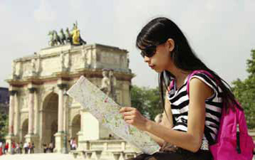 Maps are especially helpful when traveling in an unfamiliar city.
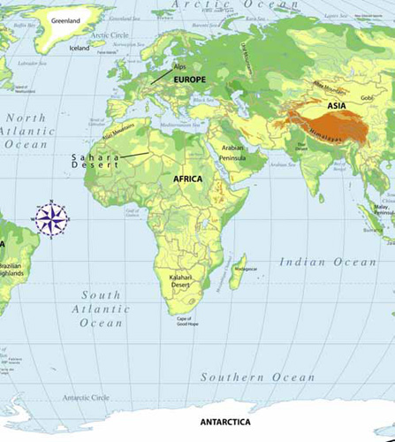 Graphical models like this map are often used in schools to help students learn about the world.
Many maps include symbols that represent different things, such as roads, bridges, streams, and campgrounds. A key explains the meaning of each symbol that appears on the map.
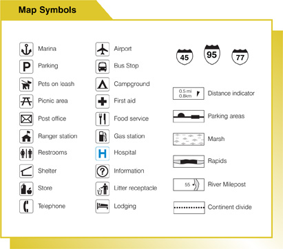
If you are traveling in the car and looking for a rest area along the highway, you would look for a specific symbol that represents a rest area on your map.
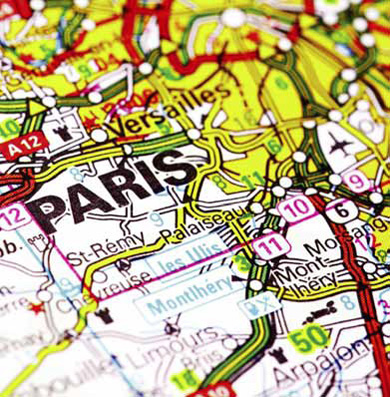 An airplane symbol helps travelers locate the closest airport.
You might want to know how far it is from your home to the library. On your map, it looks like it is just a few centimeters from one to the other. But what does this mean? You need to find the scale of your map.
Somewhere, off to the side, you will see a line that looks like a ruler. It will be in either customary or metric units. Using the scale on the map, it might tell you that 2 centimeters equals 1 kilometer. You can use this information to calculate how far it is from one place to another.
![]() On a particular map, 2 centimeters on the map represent 1 actual kilometer. Since 1 kilometer equals 100,000 centimeters, we can go on to say that the 2 centimenters on the map represent 100,000 actual centimeters. If we divide both numberes by 2, we find that the map is drawn to a scale of 1 to 50,000 (1:50,000).
On a particular map, 2 centimeters on the map represent 1 actual kilometer. Since 1 kilometer equals 100,000 centimeters, we can go on to say that the 2 centimenters on the map represent 100,000 actual centimeters. If we divide both numberes by 2, we find that the map is drawn to a scale of 1 to 50,000 (1:50,000).
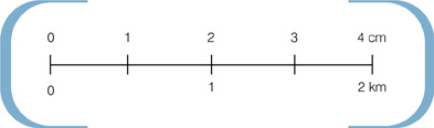 This scale, taken from the map on page 21, converts centimeters to kilometers.
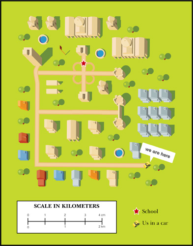 You can use a ruler, a piece of paper, or even the length of your finger to find out how far it is from place to place on this map. How many kilometers would you drive to get to school?